The Cesium AeroQuantumMag offers higher sensitivity, faster sampling rates, and allows UAV flights at speeds up to 15 m/s. However, it has drawbacks: dead zones, higher heading error, greater power consumption, additional weight, a warm-up requirement before operation, and a significantly higher cost, with an export permit required. The Overhauser AeroSmartMag, by contrast, has no dead zones, ultra-low heading error, stable and low power consumption, and is ready to operate instantly once a GNSS signal is acquired. It is one of the lightest professional magnetometers on the market, requires no export permit, and comes at a much more affordable price . Its limitations are moderate sensitivity (comparable to export-restricted optical pumped sensors), a maximum flight speed of 10 m/s, and a sample rate capped at 5 Hz.


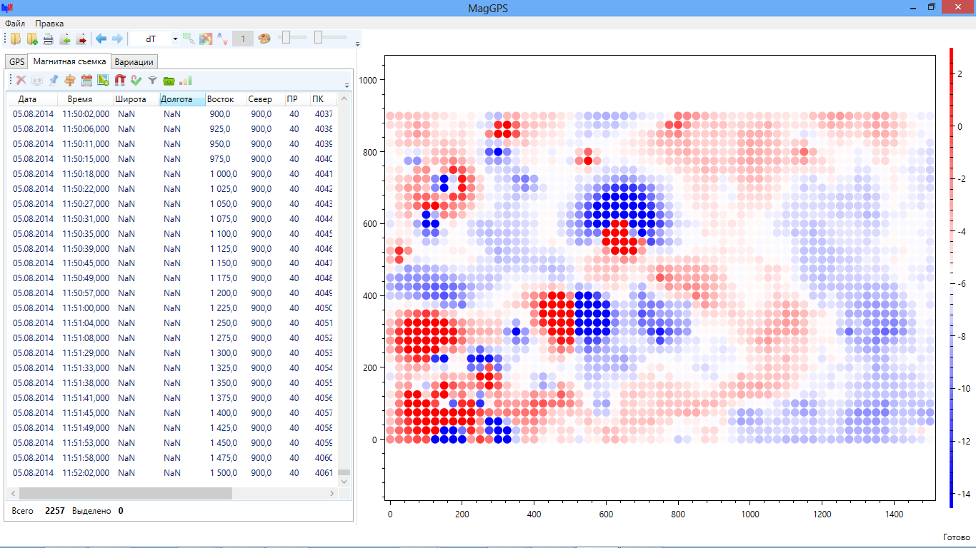
GEODEVICE magnetometers deliver high-quality data even in windy weather, near power lines, buildings, and other sources of interference. Dedicated algorithms eliminate noise and ensure measurement stability without the need for post-processing or micro-levelling.In most other systems,
accuracy is heavily dependent on conditions and
often requires additional filtering.

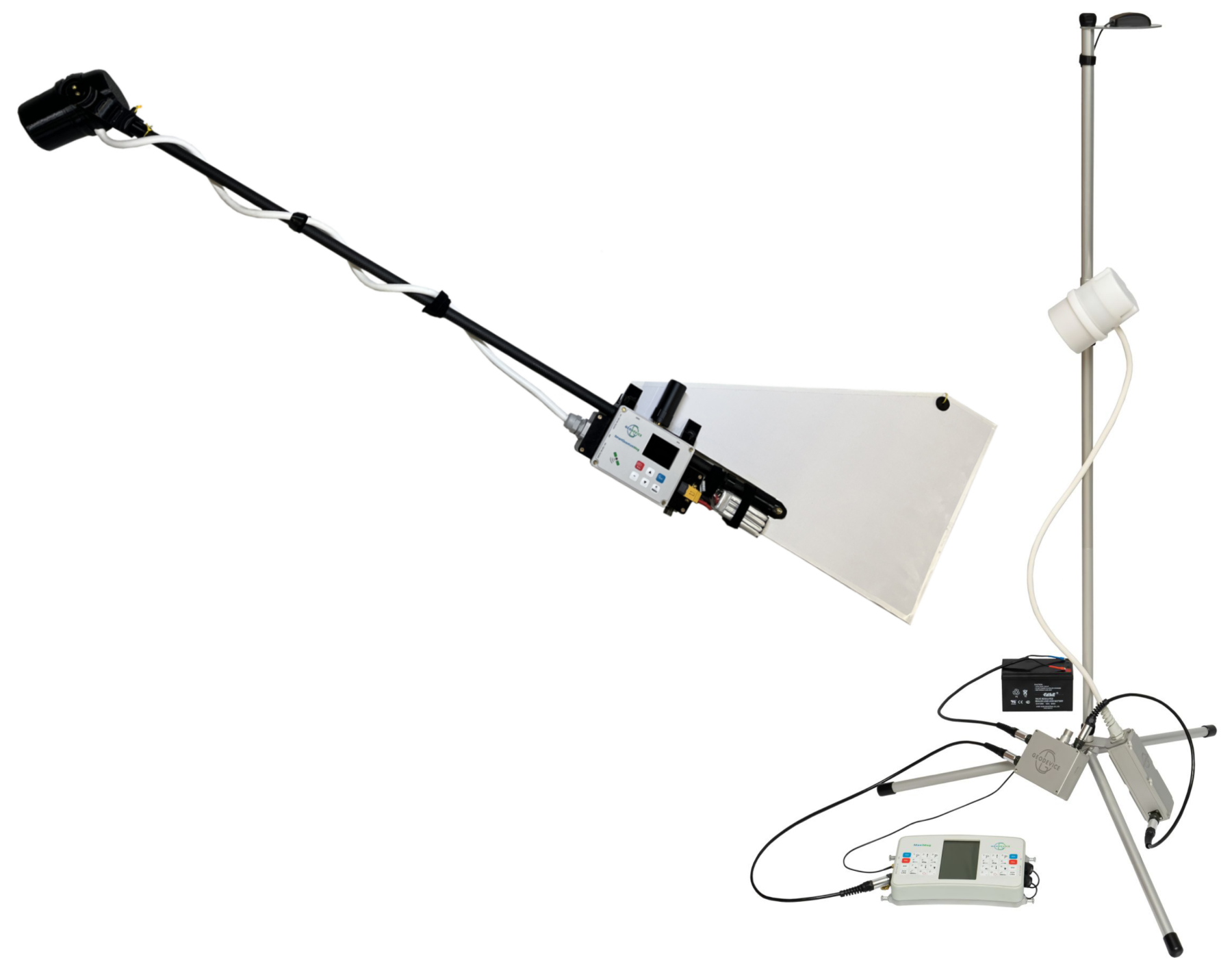
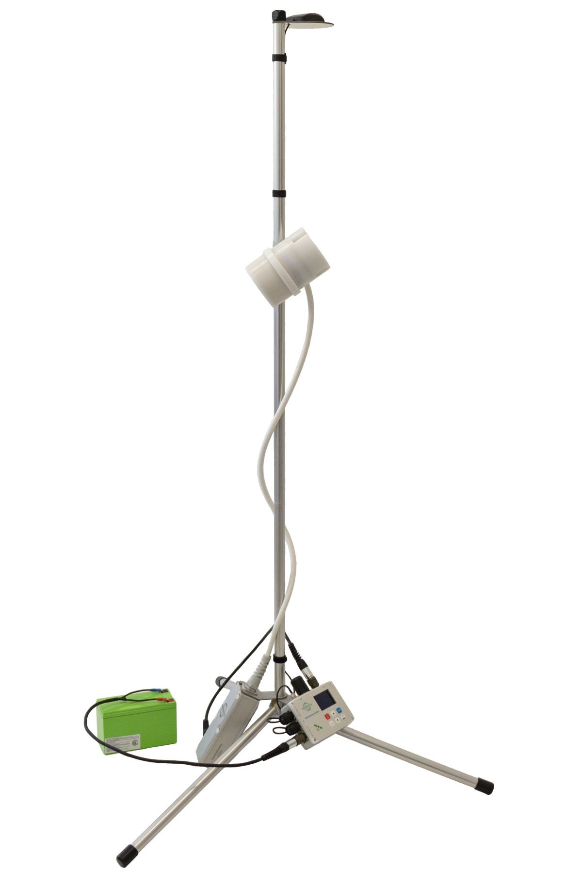
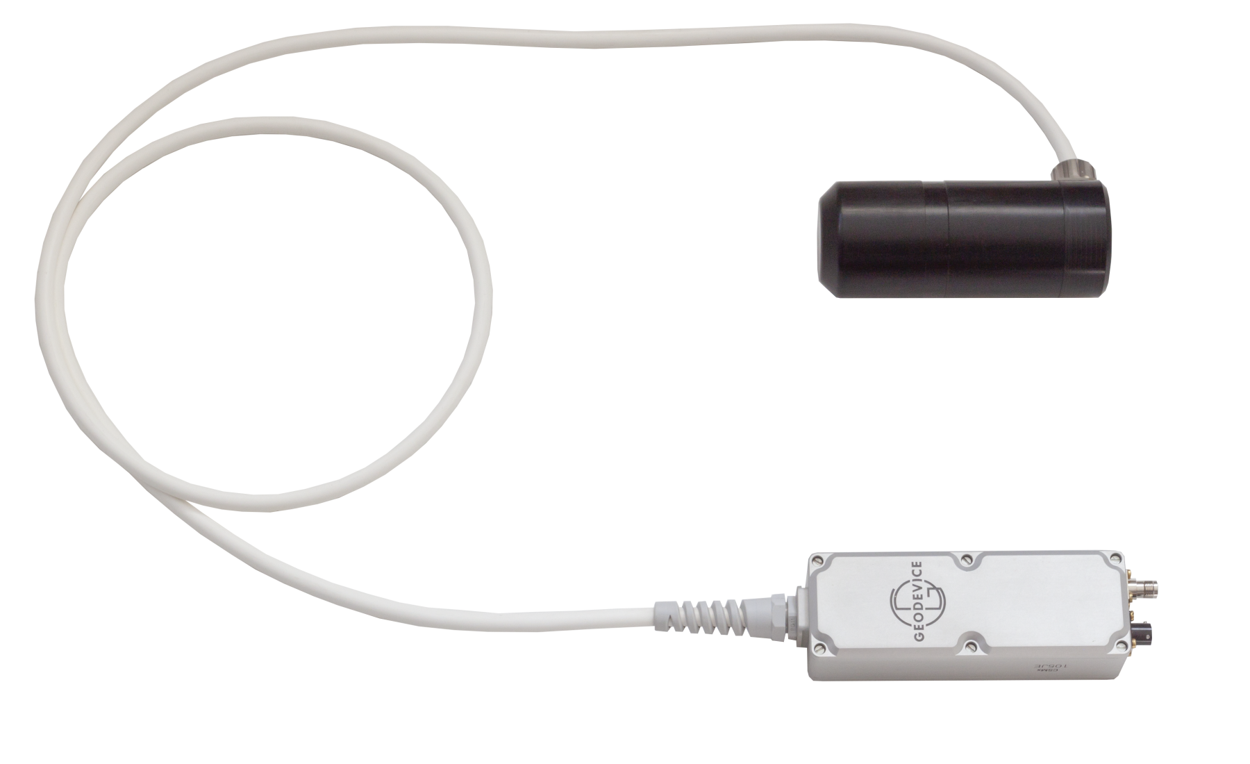
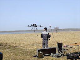
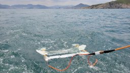
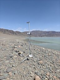
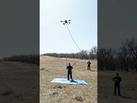
GEODEVICE equipment can operate:as a drone-mounted magnetometer,as a stationary or mobile base station,as part of a gradiometer system.Most other solutions are designed for a single application scenario.

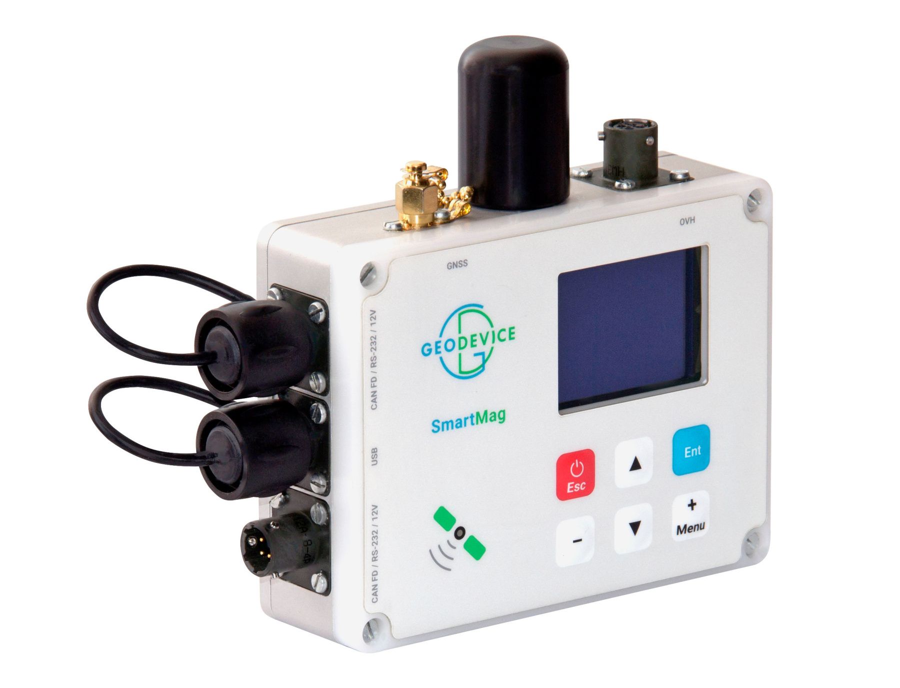
Our solutions feature a built-in multi-band GNSS receiver with RTK/PPK support and RINEX output. The magnetometer can be used as a base station, rover, or tracker without additional modules.In many other systems, GNSS capabilities are limited or require separate equipment.

GEODEVICE Overhauser sensors require no warm-up, reducing preparation time to seconds. Optimized electronics ensure long battery life, often exceeding the flight time of most UAVs. Many alternatives require sensor warm-up and offer shorter operating times.

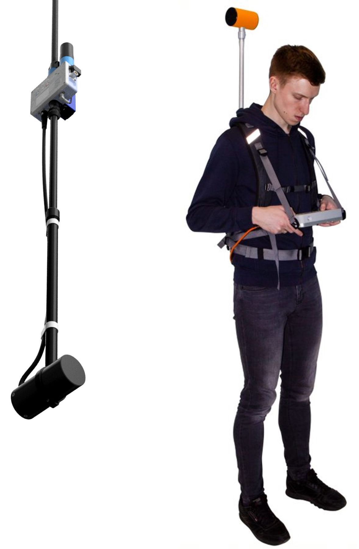
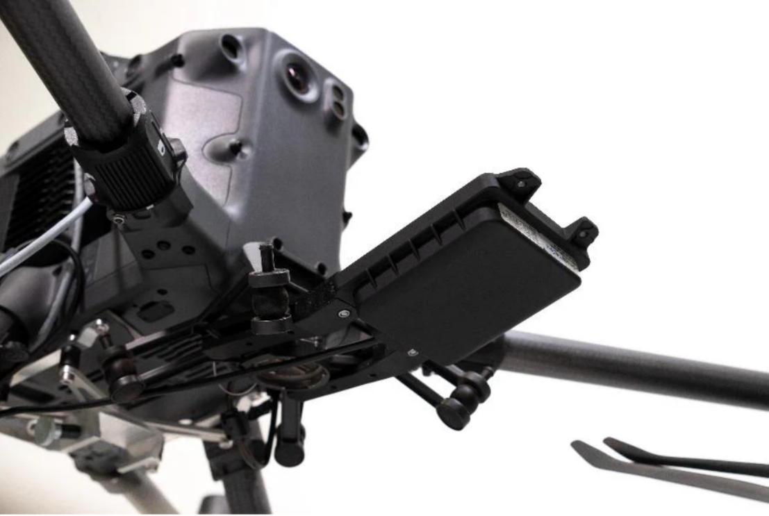
Lightweight yet durable materials, an optimized layout, and a minimal weight (approx. 1.3–1.5 kg with battery) make our devices compatible with a wide range of UAVs, including lightweight platforms.Alternative systems are often heavier and require more powerful drones.

Each unit undergoes full metrological verification for sensitivity, absolute accuracy, and heading error, ensuring that declared specifications are met in any conditions.In many systems, such verification is performed only selectively.
Our magnetometers undergo continuous testing and are backed by comprehensive metrological support, ensuring stable performance and reliable data.


Buy — Usually in stock. Order, pay, and start using right away.

Rent — Not ready to buy yet or have a short project? Rent it first. And if you like it, you can always purchase after rental.

Leasing - Always technically supported equipment, regular fixed payments, and the option to purchase at the end.
Trade-In — Upgrade your old equipment and offset part of the cost of a new system.